
File:Augsburg - Rathaus, Ludwigsplatz - 19. Jahrhundert.tif
No higher resolution available.
Augsburg_-_Rathaus,_Ludwigsplatz_-_19._Jahrhundert.tif (762 × 574 pixels, file size: 1.1 MB, MIME type: image/tiff)
Captions
Captions
Add a one-line explanation of what this file represents
Summary
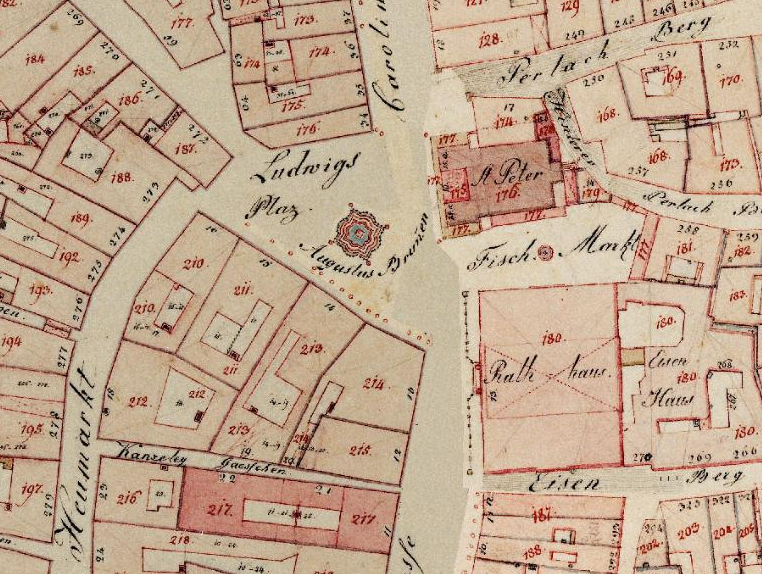
[edit]| Description |
Deutsch: Historische Flurkarte der Augsburger Innenstadt |
||||
| Date | between 1828 and 1864 | ||||
| Source | Uraufnahme, http://geoportal.bayern.de/bayernatlas/default?lon=4418460.0&lat=5359590.0&zoom=14&base=952 | ||||
| Creator |
Steuerrektifikationskommission (Königliche unmittelbare Steuerkommission) |
||||
| Permission (Reusing this file) |
|
||||
| Geotemporal data | |||||
| Heading |
 |
||||
| Georeferencing | |||||
| Camera location | | View this and other nearby images on: OpenStreetMap |
|---|
| Annotations | This image is annotated: View the annotations at Commons |
File history
Click on a date/time to view the file as it appeared at that time.
| Date/Time | Thumbnail | Dimensions | User | Comment | |
|---|---|---|---|---|---|
| current | 16:25, 26 August 2014 |  | 762 × 574 (1.1 MB) | Thgoiter (talk | contribs) | . |
You cannot overwrite this file.
File usage on Commons
The following 4 pages use this file:
File usage on other wikis
The following other wikis use this file:
- Usage on de.wikipedia.org
- Usage on fr.wikipedia.org
- Usage on ru.wikipedia.org
- Usage on www.wikidata.org